Telemetry Sensor Integration
Harnessing multi-constellation satellite bands, drone orthomosaics, and in-situ capacitive capacitance soil probes to build sub-meter moisture, biomass, and fertility models.
Multispectral Remote Sensing Protocols
True vegetation management requires analyzing light absorption across the Red (665 nm), Red Edge (705–740 nm), and Near-Infrared (842 nm) wavelengths. While simple NDVI saturates under dense mid-season corn or soybean canopies, Red Edge formulas preserve granular differentiation.
Farm ERP platforms benchmarked here ingest raw Level-1C digital numbers, apply Sen2Cor atmospheric compensation routines locally, and generate chlorophyll concentration maps in real-time.
Vegetation Indices Calculated
- NDVI (Standard Biomass): (NIR - Red) / (NIR + Red)
- NDRE (Dense Canopy Nitrogen): (NIR - RedEdge) / (NIR + RedEdge)
- EVI (Enhanced Vegetation): Corrects for atmospheric scatter & soil background
Sub-Surface Telemetry & LoRaWAN Mesh
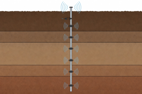
Soil capacitance probes measuring moisture and salinity down to 48 inches report via 915 MHz LoRaWAN gateways stationed at farm grain legs.
By fusing root-zone water depletion metrics with evapotranspiration (ET) predictions, operators automate irrigation pivot runtimes, saving millions of gallons of water and kilowatt-hours of pumping power.
IoT Protocol Benchmarks
- Transmission Range: Up to 14 km line-of-sight using 25mW LoRaWAN node
- Probe Battery Endurance: 7+ years with integrated solar trickle capacitor
- MQTT Broker Ingestion: Standard JSON payload over TLS 1.3 encryption